Starting from the Chalet de Bise, the Lac de Darbon hike is an invitation to discover the wide open spaces of the mountains.
You will first cross the alpine pastures of Bise, a Natura 2000 listed site and emblematic of the UNESCO Chablais Global Geopark.
You will cross 3 passes during your walk.
First, you'll climb to the Col de Bise (1915 m), where you'll enjoy a magnificent panorama of Lake Geneva, the Dent du Vélan, Lake Neuteu below, the tête de Charousse ridge to your right and the Pointe de Pavis cliffs to your left.
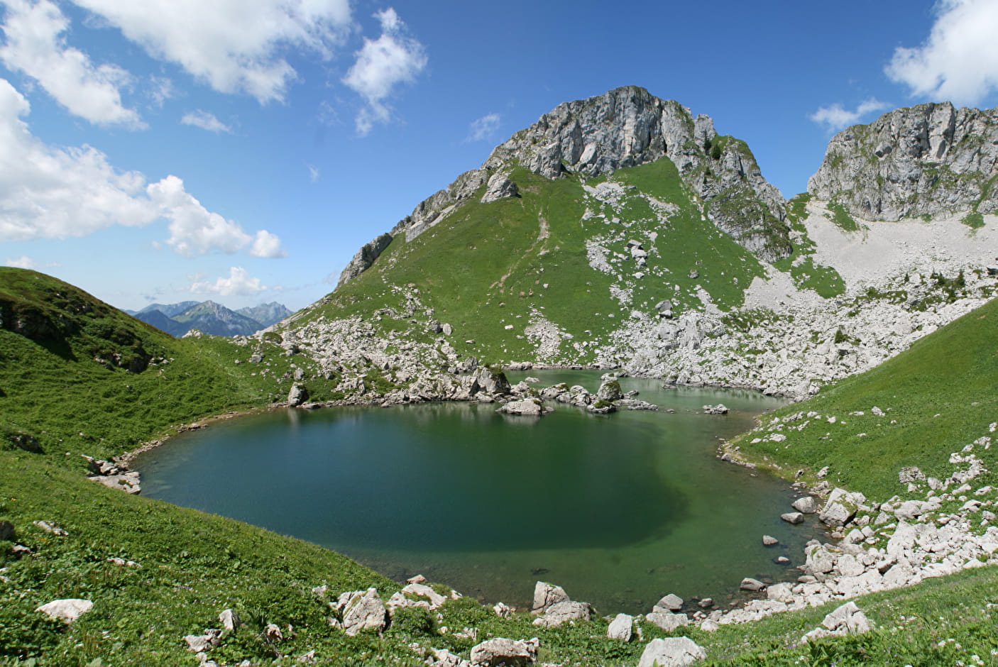
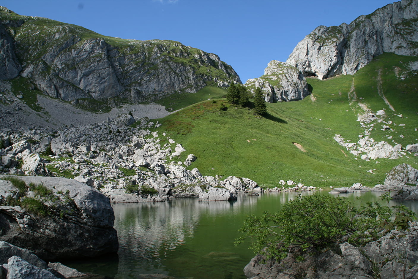
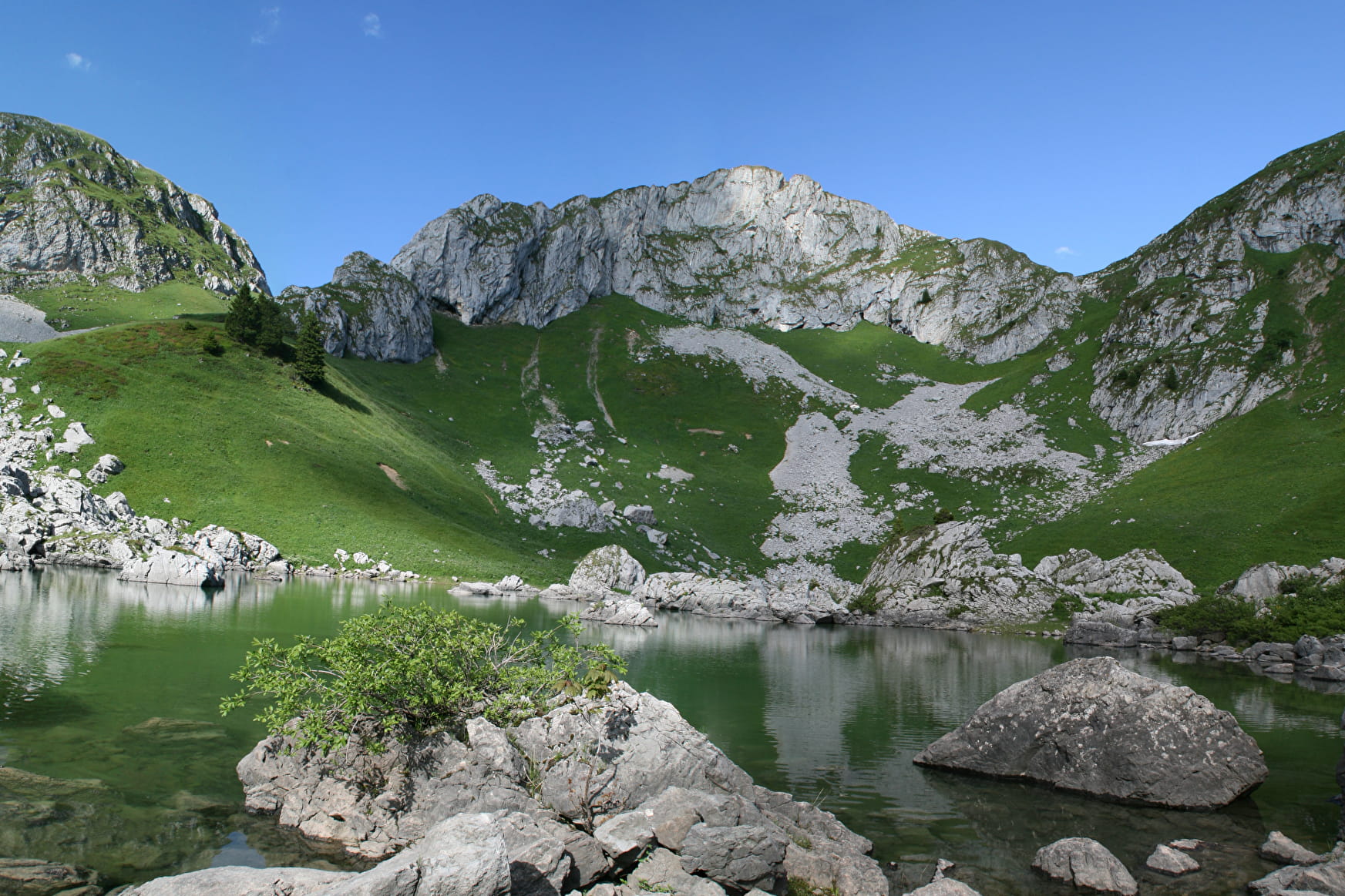
You will then reach the Col de Pavis (1944 m) and the Lac de Darbon at an altitude of 1813 metres, an ideal spot for a picnic.
Finally, you will reach your last pass, the Col de Floray (1940 m).
A steep descent takes you back to the chalets de Bise.
- Sport
Lac de Darbon via the 3 passes
A hike of medium difficulty, which will allow you to cross the authentic mountain pastures of the Chablais and to discover the Darbon lake, nestled under the beautiful peaks which surround it.
About

Signs
Departmental markings called P.D.I.P.R. on beige metal panel and green writing.
Map references
Map of the Portes du Soleil walking routes in France and Switzerland TOP 25 IGN N°3528 ET Morzine Massif du Chablais Les Portes du Soleil
Topoguides references
On sale in the tourist offices of the Abondance valley.
Further informations
Stone, Ground


1/ Take the track to the left of the stream through the hamlet of Bise, without crossing the bridge. After a flat area, the track splits in two (at a place called "la Salle").
2/ Turn right towards "Col de Bise" (GR5).
3/ At Col de Bise, head for Col de Pavis. Go around the "Pavis" and down to an intersection. The terrain is uneven, and you need to cross a few small gravel pits. Climb left towards the pass.
4/ Descend to Lac de Darbon. Go around the lake to the left and take the path rising to the left towards the Col de Floray. Follow the ridge and plunge left. The slope is steep.
5/ Then follow the pastures at the start of the hike to reach the Bise chalets.
Prices
Free access.
Reception
Whatever your hike, remember to take good walking shoes, and in your backpack, cereal bars, sufficient water, sunglasses, sunscreen, a small first aid kit, as well as clothes adapted to your outing depending on the season and the weather forecast.
Dogs must be kept on a leash because of the presence of herds and wildlife, Natura 2000 reserve and hunting reserve.
Period of practice
From 01/06 to 15/10.
Accessible except during snow and depending on weather conditions.
Please check with the Tourist Office for the latest information on access conditions. This route is usually suitable for strong walkers during spring, summer, and autumn, except in adverse weather.
- Pets welcome
- Car park
- Free car park
- Parking
Contacts
Access
From Thonon-les-Bains, follow the direction of the Valley of Abondance, Châtel. Enter Vacheresse and take the direction of Bise-Ubine, then Bise. Park at the Bise parking lot near the refuge.