From the Chenalette car park, take the path up to l'Ordière and its beacon.
There, continue straight ahead and leave the path on the left for the return.
You then reach a first footbridge that you don't know to continue on the path that runs along the Neuvache. Shortly afterwards, the path changes banks via another footbridge.
Continue on the path until you reach a cross under Lac Vert. Ignore the path on the left that continues along the Neuvache for the one on the right that will quickly reach another intersection and its beacon.
At this intersection, leave the path on the right that leads to Lac Vert, and continue on the path on the left to go deeper into this magnificent valley.
You will then reach an umpteenth beacon at Les Arendiers, to continue straight ahead in the direction of Lake Curtalés.
On the way, you will pass in front of a blockhouse then cross a scree overlooking the Plan du Fond, to finally reach the objective of this walk and its relaxing banks.
Note that it is possible to make a small detour of a few hectometres to go and see the Lac Rond and the Lac Comu located 200 metres south-east of the Lac Curtalés. To do so, follow the clearly visible path that goes in this direction.
After having taken full advantage of the place, start the descent by the same path, then after having passed the scree leave the path on the right to reach the banks of the Neuvache and its footbridge (under the sheepfold of the Barmettes).
Cross the Neuvache and continue along the path on the left, which first passes in front of the chapel of Notre-Dame-des-Neiges before reaching the Ordière and its beacon.
There, all that remains is to follow the path taken at the beginning of this hike to the right to reach the starting car park.
Translated with www.DeepL.com/Translator (free version)
- Sport
Lac de Curtalés
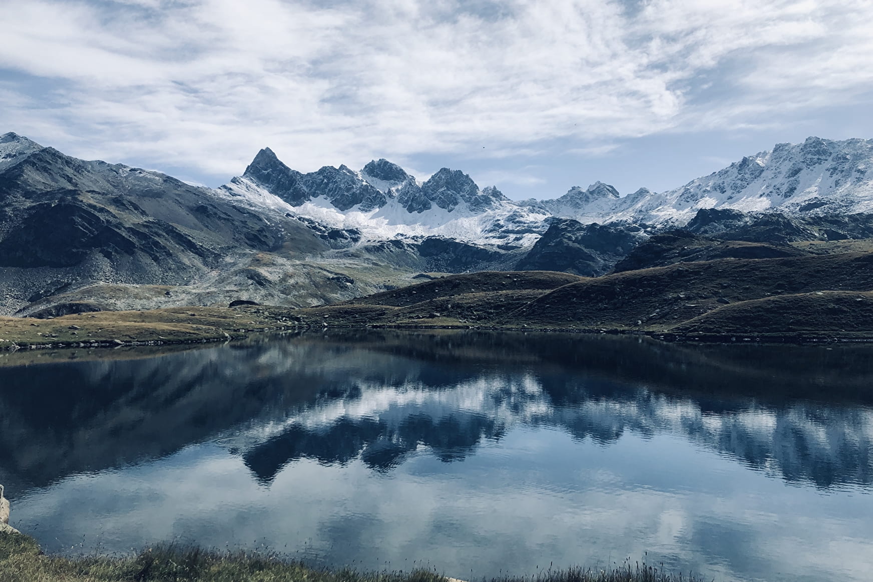
Discover Lake Curtalés and the magnificent Neuvache valley. A superb approach amidst marmots and flowers to reach this magnificent setting which benefits from a breathtaking view of the famous Mount Thabor nearby.
Sport Lac de Curtalés Valmeinier
About
Prices
Free of charge.
Reception
Period of practice
From 15/05 to 15/10.
Subject to favorable weather.
Services
- Pets welcome