
Just one kilometer long, the entire family will enjoy this walk. The few steep sections are equipped with steps and wood catwalks.
- Sport
Jardin des Panoramas / Panoramic Views Trail
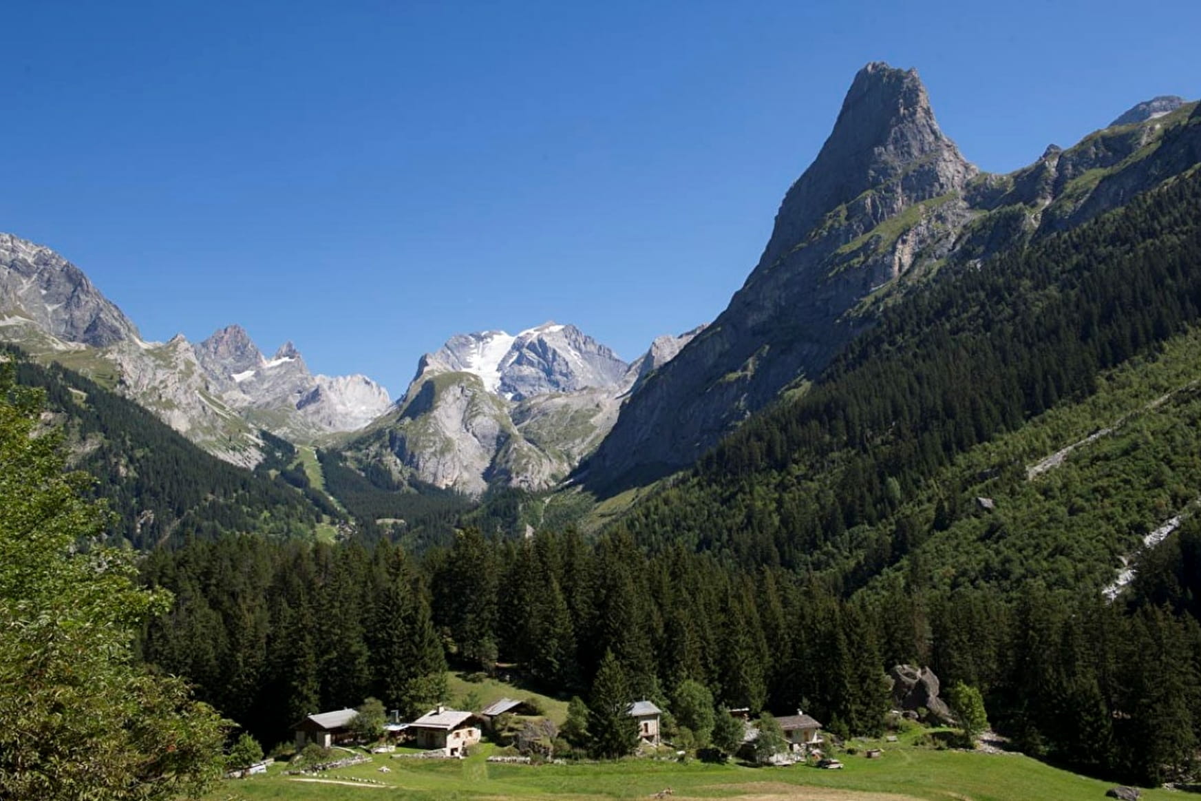
Just 10 minutes from the village center, enjoy amazing views of the iconic peaks surrounding Pralognan.
Sport Jardin des Panoramas / Panoramic Views Trail Pralognan-la-Vanoise
About

Further informations
Ground
1. From the Bouquetin car park, go up the main street, pass in front of the "Vacanciel" residence and then follow the route du Plateau until you reach the signs for the entrance to the Chavière valley.
2. The Jardin des Panoramas trail first runs along the Doron de Chavière (trail no. 66) and rises on the wooded conifer hill overlooking the plateau and the hamlet of Chollière.
Objects for reading the landscape are scattered along the path, you will find an orientation table or a telescope and four belvederes, which will allow you to interpret the different landscapes of the Chavière valley.
VARIANTS of ascent:
1. Path n° 67 (then 68) known as “Squirrels” or “route des Creux”
To reach the hamlet of Chollière and the Rocher des Singes where we discover the first belvedere.
Prices
Free access.
Reception
Period of practice
From 01/05 to 30/11.
Subject to favorable snow and weather conditions.
Services
- Pets welcome
Contacts
Access
Nearby car park : Bouquetin car park