Get to Plan Bois by car or gondola.
From the small parking lot near Chez Laurette "Le Plan Bois" restaurant, follow the dirt road towards Plagne Bellecôte (P) for 10 minutes.
After crossing the often-dry torrent, fork left (P) and follow the well-marked path up through the forest. Once you reach a large clearing, the path continues to climb through the pines. At the next intersection, continue to the right (P). The forest gradually disappears, giving way to flower-filled grassland inhabited by marmots. After this long crossing, the path leads to a wide pass. Climb up the vast meadow to the right and reach the summit of Mont Saint Jacques in 20 min.
The return journey takes the same route and reveals a completely different landscape.
2nd option: return to Plan Bois without a car:
On the way back down from Mont Saint Jacques, you can head for the tête des Arpettes (Plagne Ange) and take the Carroley trail down into the Bauches valley. Head towards the Restaurant le Friolin, then continue along the road to a small bridge and, on your left, enter the sentier du Bief as far as Le Coches (take care if you've left your car at Plan Bois).
3rd option: return by car to Plan Bois or by gondola:
On the way back down from Mont Saint Jacques, you can head for the tête des Arpettes (Plagne Ange), take the white dirt road on your left and then head for the snow line overlooking Lac du Carroley, You'll pass by the Bijolin chairlift and take the white dirt road towards Lac des Pierres Blanches, from where you can return along the blueberry trail down to Plan Bois (return by car to Montchavin-Les Coches or by the Lac Noir gondola - please note gondola opening times).
- Sport
Hiking trail: Mont Saint Jacques
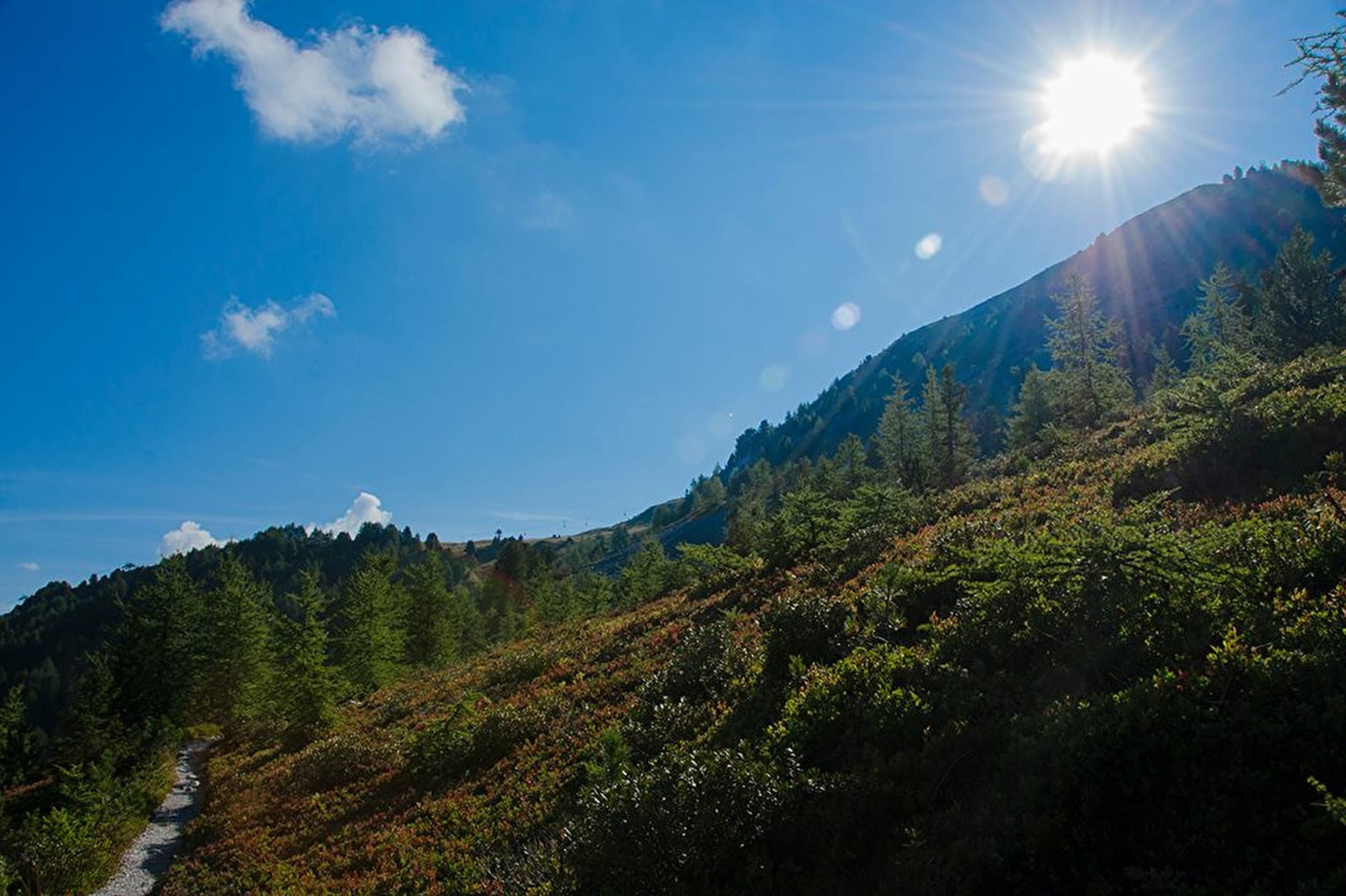
Mont Saint Jacques has fabulous views of the Tarentaise valley and the Mont Blanc, Beaufortain, and Vanoise massifs. This lovely trail takes you through an exceptional site with an abundance of Swiss pines.
About

Further informations
Stone, Ground


Prices
Free access. Single price: 8 €
1 day La Plagne pedestrian/MTB
- Adult (from 13 years old): 22 €
- Child (5 to 12 years old included): 18 €
1 week La Plagne pedestrian/MTB
- Adult (from 13 years old): 47 €
- Child (5 to 12 years old included): 38 €
Purchase in Tourist Offices.
Reception
Whatever hike you opt for, remember to put cereal bars, enough water, sunglasses, sun cream and a small first aid kit in your backpack, as well as suitable clothes for your outing according to the season and the weather forecast
Be careful, you may have herds of cows on your route
Period of practice
From 29/06 to 31/08/2024.
- Pets welcome
- Accessible via ski lift
Contacts
Access
1 - Go to Plan Bois with your vehicle and park in the car park after the restaurant Chez Laurette (mountain road 30km hour).
2 - Go to Les Coches and take the Plan Bois chairlift and go down on your right towards the entrance to the trail (Les Frasses)


