Departure: Plan Chevallier car park
1. from the car park you can either follow the road or take the Gypaète forest path which will join the road a little further on.
2. continue on the road which leads to the village of Outredière (889 m).
3. In the village, follow the sign indicating Doran via the Gypaète trail.
4. Just before taking the path on the left, admire the view of the Voice Stone in the distance.
5. Follow the path to the left with the small signs.
6. You will arrive at a junction, at a place called "les Pendants", where you will have to continue on the Gypaète trail (unless you want to make a detour to see this famous Pierre à Voix which is 10 min away).
7. continue along this forest path all the way up to the next sign which will tell you to take the dirt road on the left which rises through the fields, then into the forest. The climb is sustained, but also offers great opportunities for rest to admire the plunging views over the Arve valley. In the distance, dominates the Mont-Blanc massif.
8. Approaching the Prés d'Outredière chalets, the route turns sharply 90 ° to the left at the edge of the field, and continues along a narrow path that crosses several streams and climbs in tight zig-zags through the maple trees. , to the foot of the cliff.
9. A short crossing on the mountainside will take you to cross the Torrent de Dière (water catchment).
* Please note, this bridge is dismantled in winter and the corresponding indication - open / closed - is then indicated on the markings in place at the exit of the hamlet of Outredière.
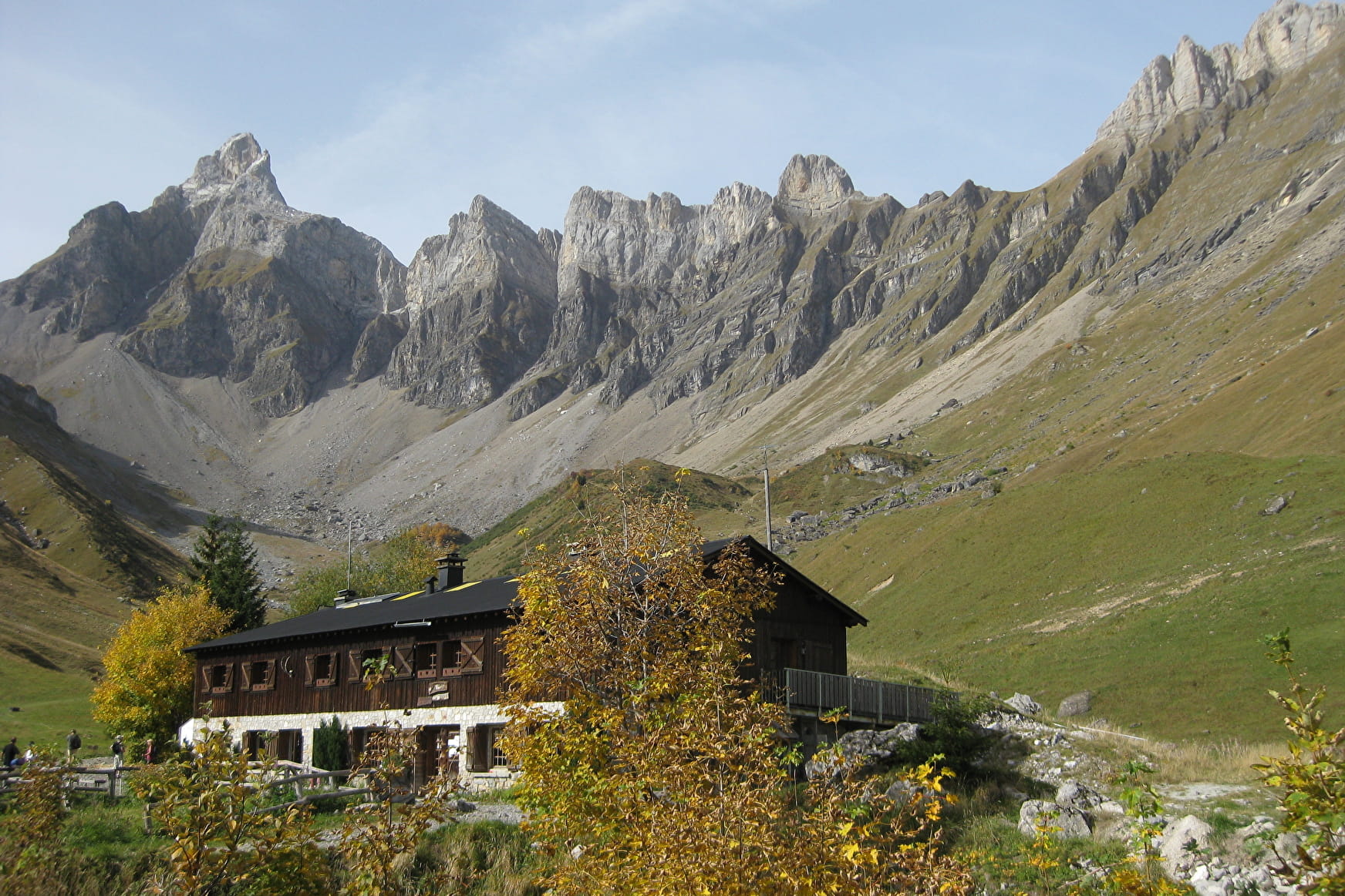
9. Shortly after the footbridge, the path continues to the right by a few wooden steps, and you then reach the valley of Doran and its chalets.
Nestled in the heart of a grandiose mountain cirque dominated by Pointe Percée, the highest point of the Aravis, the Doran pasture invites you to discover - from June to September - its ancestral agro-pastoral and cheese activity where you can buy cheese. fresh, the astonishing history of a chapel built by the scouts, the fauna and flora of the alp and in particular the astonishing Bearded Vulture, reintroduced here a few years ago. And of course the charming Doran refuge which will welcome you there for a drink, a blueberry pie or even offer you a lodging for the night.
Many hikes also start from this mountain pasture: the Saix ridge to reach Mayères, the Col de Doran for Quatre-Tête or Pointe Percée or even the towers and Pointe d'Areu ....
10. We advise you to go back down in a loop by taking the 4x4 trail
11. on the plateau before arriving, turn left to join Plan Chevalier by the forest track.
11. The round trip is less recommended because the slope is a little steep for a descent, but achievable for those who wish it.
Walking time is approximate and does not include break times.
Go on a safe hike!
This description allows you to orient yourself globally but does not replace a hiking map at 1/25000 or other topoguides that you can find in your tourist office! In Sallanches, our Office of Guides & Accompanists also offers a wide choice of outings accompanied by mountain professionals providing you with complete expertise on the environment and alpine nature, think about it!
Whatever your hike, check the weather before heading out.
Remember to take cereal bars, sufficient water, sunglasses, sunscreen, a small first-aid kit, as well as clothes suitable for your outing depending on the season in your backpack. and the forecast forecast.
- Sport
Hiking Trail: Doran via the Gypaète trail
This forest path, whose slopes are a little steeper than the classic route, allows you to stay cool in the summer but especially, ensures you avoid the 4x4s.
On arrival, there is a magnificent view over the Pointe Percée, the highest point (2750 m) in the Aravis range.
Sport Hiking Trail: Doran via the Gypaète trail Sallanches
About

Further informations
Ground, Grit
1 19


Prices
Free access.
Reception
Period of practice
From 15/05 to 15/10.
Subject to favorable snow and weather conditions.
Services
- Pets welcome
- Accommodation
- Restaurant
- Car park
- Free car park


