The hike begins on the parking lot of the refreshment room.
Take the path which rises in laces in the forest.
At the first crossing, continueacross until the second crossing indicating "The Plan Meulet" on the left and take this direction.
Follow the way which winds in the forest up to the high mountain pastures of "Plan Meulet".
Follow the path on the crests which leaves to the right.
The summit is not still visible but take time to observe the magnificent view of the valley which opens in front of you.
Continue to the top of the Mole, don't hesitate to go to the cross.
The descent is made by the Small Mole and the Locality "La Ladère" then the Locality "La Ravire". The following of the descent is then made by a long and wide way of track.
- Sport
Hiking track - Le Môle
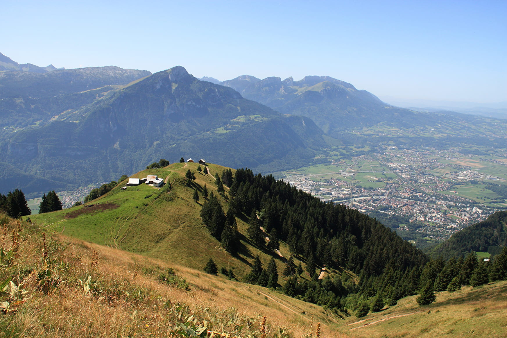
Belvedere of Faucigny, nicknamed Fuji-Yama of the Alps, especially when the first snows offers it a white hat on its summit.
360 °view, with a panorama of the chain(channel) of the Mont Blanc, Aravis, La Pointe d'Andey, the Lac Léman and its fountain...
Sport Hiking track - Le Môle Saint-Jean-de-Tholome
About

Further informations
Stone, Ground
1 1

Reception
Period of practice
All year round.
Services
- Pets welcome
