Les Bauches, a beautiful "secret" valley in Montchavin-Les Coches where Pramain stream marks the start of the trail before taking you to the end of the valley with lush grassy areas all the way to Lac du Carroley. You will also see herds of cows and sheep in the mountain pastures.
Lac du Carroley is a beautiful mountain lake where you you can observe fish, tadpoles and frogs.
- Sport
Hiking trail: Lac du Carroley
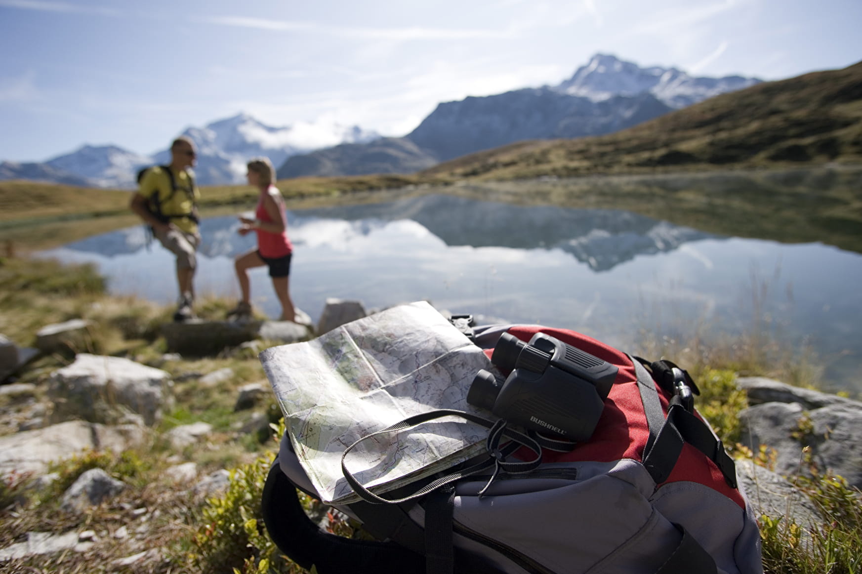
A lovely family walk with fabulous views of Mont Blanc and Mont Pourri
Sport Hiking trail: Lac du Carroley Montchavin-les-Coches
About

Signs
The trail is marked with beige signs + blue writing.
Difficult passages
Watch out for the creek crossing, which can be substantial depending on snowmelt and rainfall.
Map references
IGN map Les Arcs La Plagne 3532ET on sale in sports stores and newsagents - You can also find all our itineraries on sale in our tourist offices (€5).
Further informations
Rock, Stone, Ground
1 2


Start from: valley of Les Bauches
1/ Drive along the Les Coches road? At Fontaine Froide (junction), keep following the signs for "Les Bauches en voiture" until the end of the road (Les Bauches car park).
2/ Follow the asphalt road past the Auberge du Friolin and then the track that climbs up to the right of Pramain stream.
3/ After crossing the stream (ford), carry on up the switchbacks to Le Dérochoir (wet rocks).
4/ Once there, follow a path to the right which levels out and crosses varied terrain before reaching the Chalet du Carroley. After climbing though a few meadows, you reach the lake.
5/ After a good picnic, walk back down to the chalet and then down to the car park on the narrow road.
The trail is marked with beige signs + blue writing
Prices
Free access.
Reception
Whenever you go hiking, remember to take cereal bars, plenty of water, sunglasses, sun cream and a small first aid kit, as well as suitable clothes for your outing, according to the season and the weather forecast.
Period of practice
From 29/06 to 31/08/2024.
Services
- Pets welcome

