Refreshment bar and small restaurant.
This route follows the Vallée Blanche exit created in 1968 to facilitate
the exploitation of the woods and the return of the skiers to the valley. From the level crossing, go up the Planards ski run along the Montenvers railroad. Leave the Montenvers path on the right and continue straight on the path at the bottom of the meadow. Continue in the forest until the farm of Planards where you cross the Montenvers train line. After a few switchbacks, go up to the couloir d'Orthaz (beware of falling rocks) and go up the bends of the Cé. Follow a long false flat: the track cuts the path coming from the woods and, after the Filiaz corridor, it leaves the forest, climbs the red rocks and arrives at the viewpoint.
30 minutes more walking you can reach the Montenvers site.
Another possible route from Les Bois.
More information available at the Tourist Office, the High Mountain Office or in our trail guide.
Attention : The conditions of the trails are likely to change, think of informing you before leaving.
- Sport
Hike to Rochers des Mottets
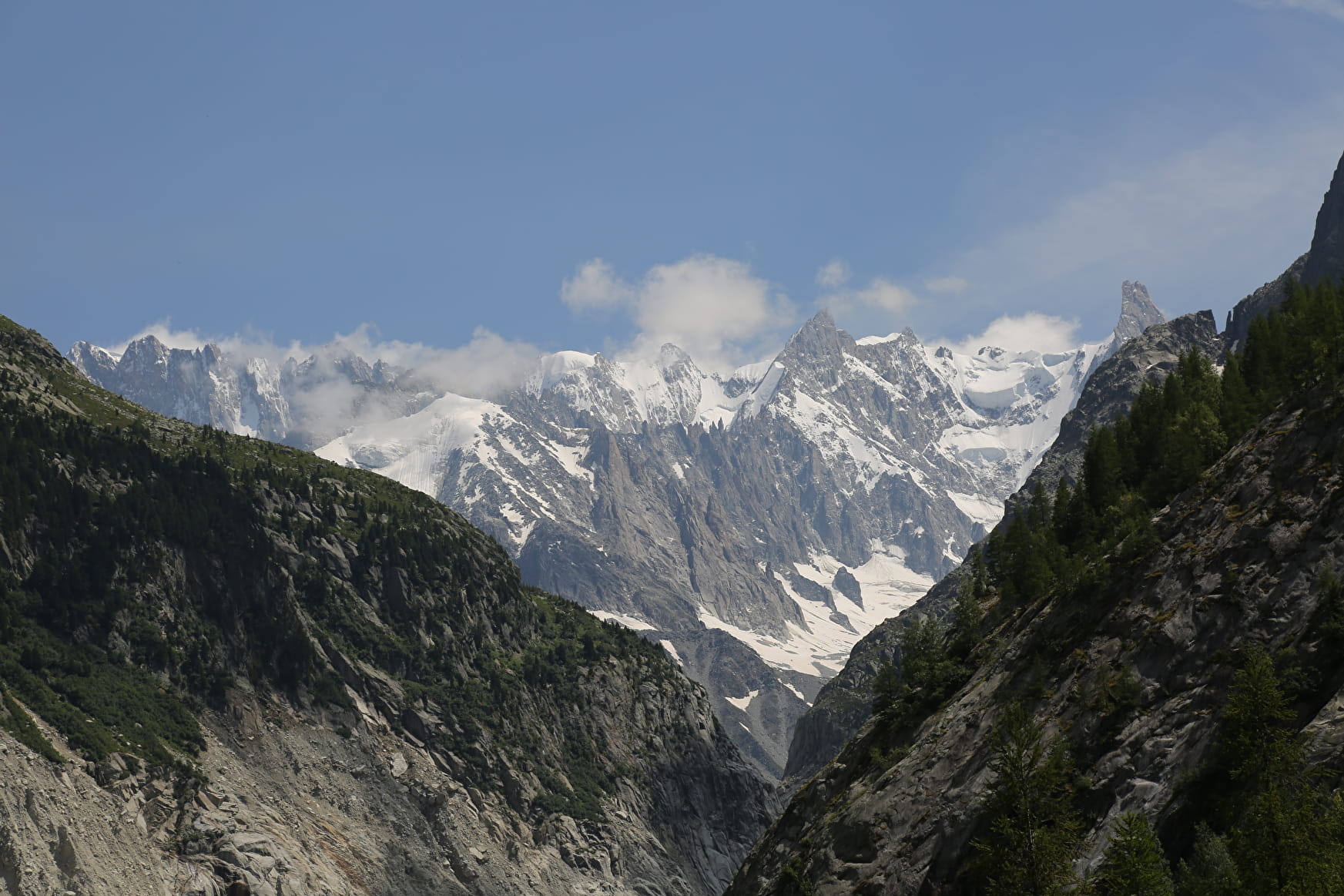
Splendid point of view on the Aiguilles des Drus. Amazing site of red rocks. View on the Mer de Glace. Path realized by the Commune of Chamonix and the Office National des Forêts.
Sport Hike to Rochers des Mottets Chamonix-Mont-Blanc
About

Signs
The trail is marked with hiking signs.
Further informations
Stone, Ground
1 4


Reception
Period of practice
From 01/05 to 31/10.
Access depending on meteorological conditions. For more information, contact the High Mountain Office of Chamonix: +33 (0)4 50 53 22 08. Website : (http://www.chamoniarde.com/).
Services
- Pets welcome
Contacts
Access
Closest bus stop : Place Mont-Blanc
Mulet stop : Chamonix train station
Closest train stop : Chamonix train station
Closest parking : Les Planards / Le Biollay car-parks


