This route from Bernex takes you through the alpine pastures and forests of Mont César.
A short section follows the GR Balcon du Léman trail to the Col de Pertuis, passing close to La Colombière and the Pic des Mémises.
Beautiful panoramic views are offered throughout this hike, which alternates between lake, mountain pastures and mountains.
Variation: you can make a return trip to Pic des Mémises during the hike.
- Sport
Tour of Mont César from Bernex
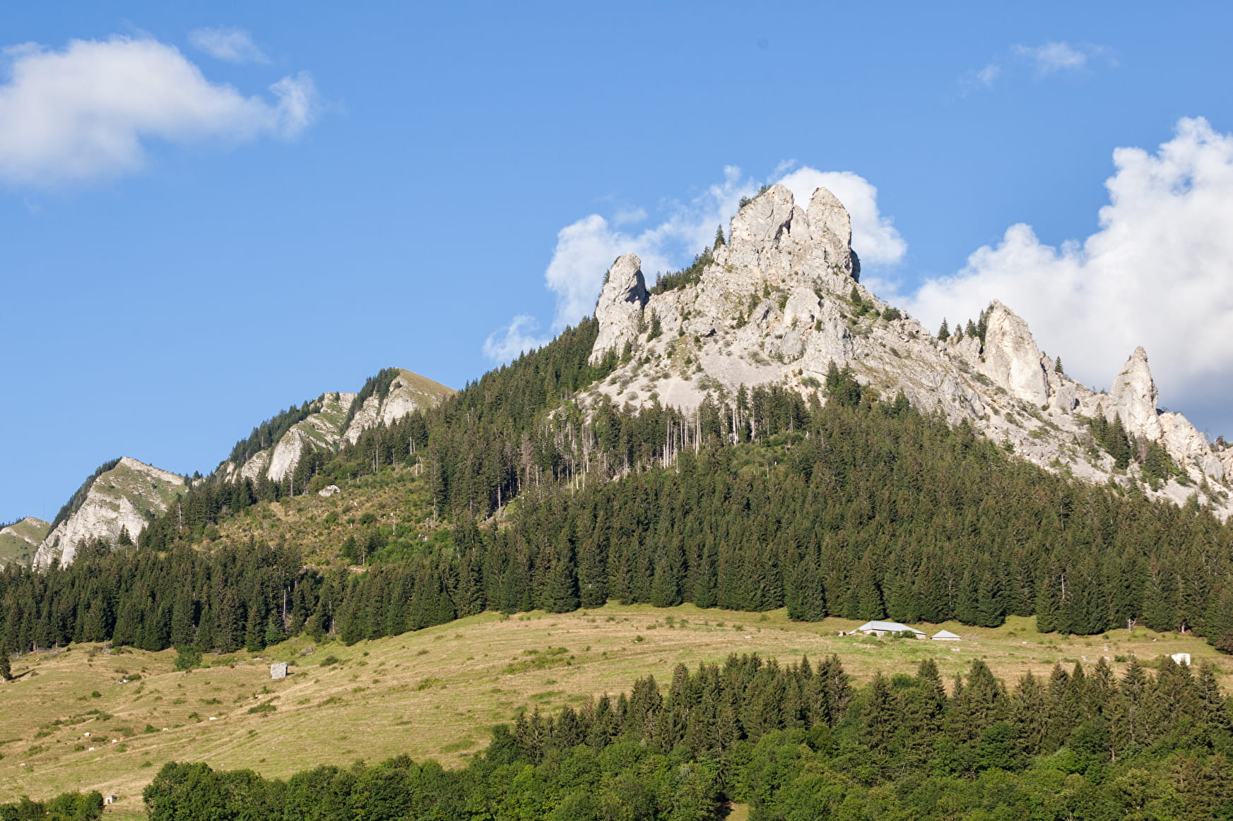
This itinerary allows you to walk around the Mont César (1548 m) and the Colombière (1512 m) and to cover a mountain atmosphere with alternating views of Lake Geneva and the Dent d'Oche.
Sport Tour of Mont César from Bernex Bernex
About

Signs
PDIPR signposting with beige metal panels and green writing
Map references
TOP 25 N°3528 ET
Topoguides references
On sale in the tourist offices of the pays d’Évian.
Further informations
Stone, Ground
1 2


0/ Start from the Creusaz parking lot in Bernex. 1/ Take the path towards "Sur la Rasse". 2/ Follow the path through the forest. 3/ At the junction with the GR Balcon du Léman, take the path to the right towards "Sur les Prés". 4/ Once you've reached "Chalets sur les Prés", leave the GR and take the path above the chalets, where you'll come to the "crête du Grand Mottay". 5/ Take the left-hand path towards the "Col de Pertuis". 6/ At the Col de Pertuis, head back down towards Creusaz to return to the start.
Pic des Mémises variant (1675 m): at Col de Pertuis, head towards Pic des Mémises.
Prices
Free access.
Reception
Be well shod for this hike.
It is recommended not to climb the Mont César.
Dogs must be kept on a leash because of the presence of herds.
Period of practice
From 01/05 to 30/11.
Accessible outside the snowy period and depending on the weather conditions. Please check with the Tourist Office beforehand to find out the current access conditions.
Services
- Pets welcome
- Picnic area
- Car park
- Parking
Contacts
Access
Free parking The Creusaz in Bernex.

