D/ Chaffardon car park, route de Lovettaz, St Jean d'Arvey
1/ From the car park, take the main road and follow it for about 50m in the direction of Lovettaz.
2/ Take the downhill path on your left, signposted "cascade".
In just a few minutes, you'll reach the local conservatory orchard, where you can enjoy an unobstructed view of Chambéry and its valley.
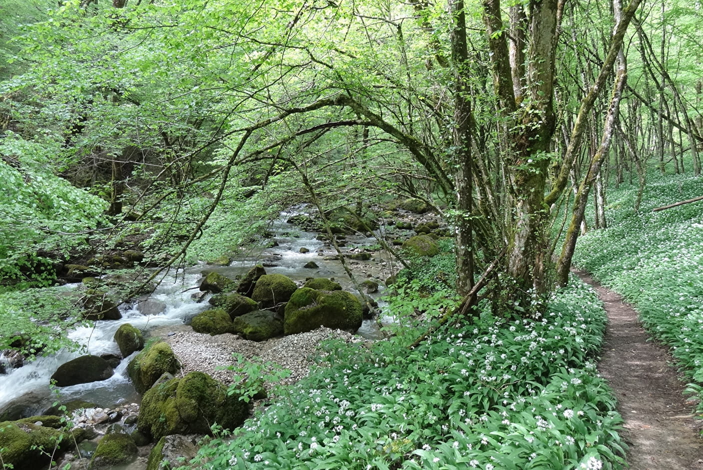
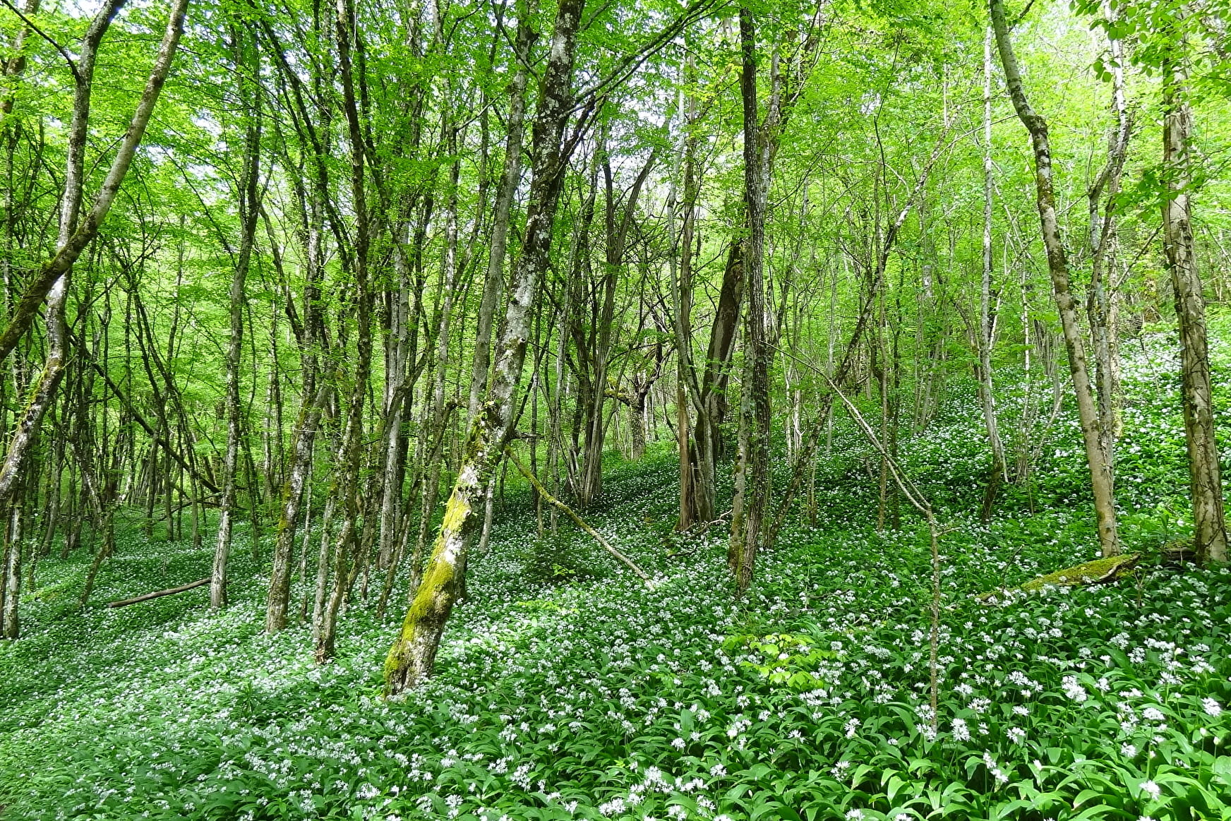
3/ Continue along the path on your right, which goes deep into the forest.
From here, follow the yellow markings and the "Cascade de la Doria" signs, continuing along a path on the side.
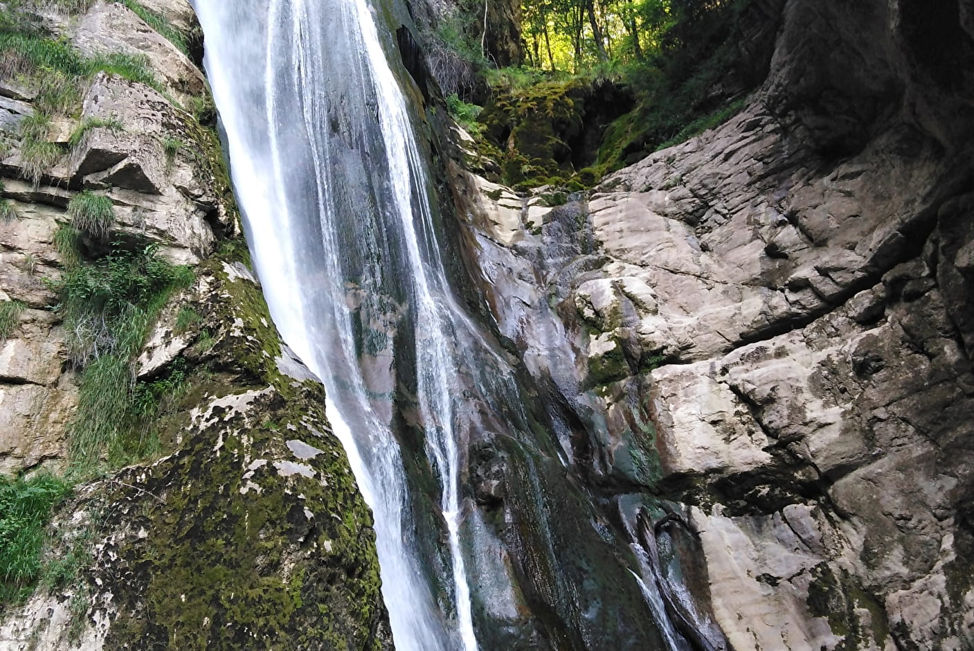
The path takes you to a viewpoint overlooking the Doria waterfall, which falls from a height of 60m.
>> This is just one of many waterfalls on the Doria, from its source at the trou de la Doria to its confluence with the Leysse at the "end of the world" in St Alban de Leysse >>.
4/ Then continue along the same path, which takes in a rocky section with cables.
Follow the Doria to an old hydroelectric power station, now in ruins.
5/ Continue for another 100m and take a path towards the Chaffardon arboretum.
From here, follow the GR markings and the direction of the arboretum until you reach it.
6/ Return to the car park along the path you followed on the way out.
------------------------------------------------------------------------------------------------------------
Please note:
The flow of the Doria waterfall varies greatly with the seasons, giving a new aspect to each visit. On the way back, take the time to read the panels presenting the trees in the arboretum!
- Sport
Great waterfall of the Doria river
This cool, shady trail takes you on a journey through nature and history. The path's steep slopes will earn you a view of the splendid Doria waterfall. Periods of heavy rain give the Doria an exceptional flow.
About

Signs
Partially signposted route. Yellow markings for the first half, then GR markings (red and white).
Difficult passages
A ledge passes over the path above, then a cabled passage on the way down. The climb back up through the arboretum is also steep. This route is not recommended in wet weather as it can be slippery.
Further informations
Rock, Stone, Ground


D/ Chaffardon car park, route de Lovettaz, St Jean d'Arvey 1/ From the car park, take the main road and follow it for about 50m in the direction of Lovettaz. 2/ Take the downhill path on your left, signposted "cascade". In just a few minutes, you'll reach the local conservatory orchard, where you can enjoy an unobstructed view of Chambéry and its valley. 3/ Continue along the path on your right, which goes deep into the forest. From here, follow the yellow markings and the "Cascade de la Doria" signs, continuing along a path on the side. The path takes you to a viewpoint overlooking the 60m-high Cascade de la Doria. >> This is just one of the many waterfalls that form the Doria, from its source at the trou de la Doria to its confluence with the Leysse at the "end of the world" in St Alban de Leysse.>> 4/ Then continue on the same path, which follows a rocky section with cables. Follow the Doria to an old hydroelectric power station, now in ruins. 5/ Continue for another 100m and take a path towards the Chaffardon arboretum. From here, follow the GR markings and the direction of the arboretum until you reach it. 6/ Return to the car park along the path you followed on the way out.
Prices
Free of charge.
Reception
Pets must be kept on a lead.
Period of practice
From 01/05 to 31/10.
Subject to favorable snow and weather conditions.
- Pets welcome
- Coach access
- Car park
- Free car park
Contacts
Access
On the way up from Chambéry, look out for the "Site Touristique" sign indicating a small road to the left just as you enter the commune of St Jean d'Arvey, so that you can easily find the route de Lovettaz and the car park.