Go to the menu
Go to the content
Menu
Sport
Croix de Colomban
Walking
Croix de Colomban
GPX trail
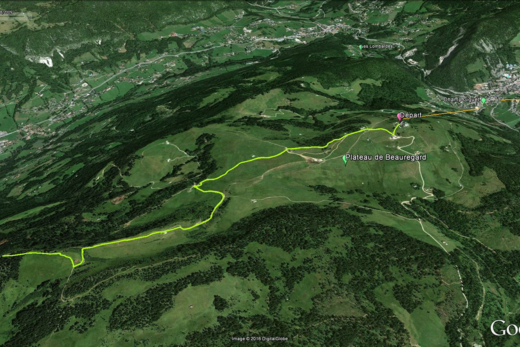
Sport
Croix de Colomban
La Clusaz
GPX trail
About
Contact
Opening
Reception
Access
More informations
About
Departing from La Clusaz (74220)
Average length : 01h45
Distance : 7km
Signed walking trail
Open the map
Lire la suite
Réduire
Further informations
Way and back
Total elevation gain
: 284m
Altitude max
: 1691m
Vertical drop
: 284m
Further informations
Stone, Ground
Reception
Languages spoken :
French
Period of practice
From 01/05 to 31/10.
Lire la suite
Réduire
Benefits
Equipments
Picnic area
Covered picnic area
Public WC
Orientation board
Contacts
04 50 32 65 00
Contact by mail
Access to the website
Access
Pointe de Beauregard
74220 La Clusaz
Departing from
: La Clusaz (74220)
Latitude :
45.89376 -
Longitude :
6.406509
Information update on 08/07/2016 by Office de Tourisme de La Clusaz
Back
Continue
Discover our ski resorts
Close
Close
Formulaire de contact
Contact SIT
Last name
*
First name
*
Email
*
Phone number
Subject
*
Message
*
Confidentiality
*
By checking this box and submitting this form, I agree that my personal data will be used to contact me as part of my request indicated in this form. No other processing will be carried out with my information.
reCAPTCHA
If you are human, leave this field blank.
Send
Close
Your research...
Discover
Winter mountains
Great lakes
Summer destination
Activities
Snowsports
Nordic
Outdoor
Hiking
Cycling
Visits
Gastronomy
Your stay
Accommodation
Things to do
Events
Contacts
Facebook
Instagram
Twitter
Youtube
TikTok
Back
fr
en
To search for a topic, just type a word or phrase in the Search box
No results find.
Menu