
Camine por el entorno mineral del Col Rouge, entre pedregales de color oscuro y luego cargneules y arcilla de color ocre. Desde el collado, disfrute de una vista panorámica de los glaciares de la Vanoise y de toda la zona de Trois Vallées (Mont Vallon, Aiguille du Fruit, Aiguille du Borgne...). A la bajada, una merecida parada en el pasto de montaña de Ritord le permitirá degustar los diferentes quesos producidos del valle.
We recommend an early start, as the part of the route between the Ritord chalets and the Col Rouge is in direct sunlight. Please note that there are no water points on the route! The trail can be tricky, especially after torrential rain.
- Sport
Col Rouge Pass
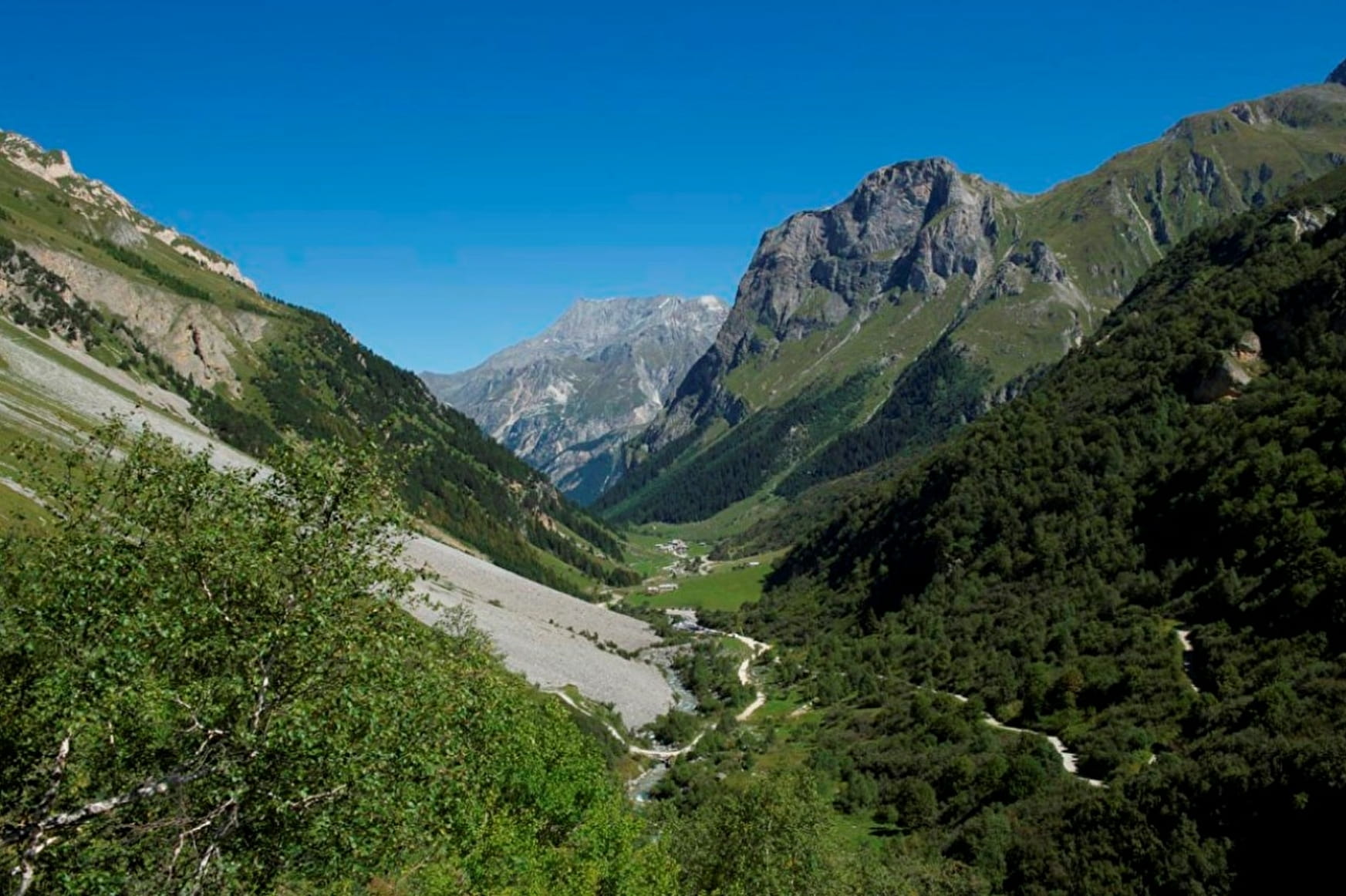
A fantastic excursion through one of Pralognan’s wilder areas, where local herds of chamois and alpine ibex often spend their time. Col Rouge Pass offers spectacular views of the Three Valleys.
Sport Col Rouge Pass Pralognan-la-Vanoise
About

Map references
Pralognan-la-Vanoise trail map.
Further informations
Rock, Stone, Ground, Grit
1. From the Pont de la Pêche car park, take the pastoral route up to the Ritord mountain pasture (footpaths 49 and 49b), passing the Roc de la Pêche refuge (1,911 m).
2. At the Ritord mountain pasture, continue along the path towards the Péclet-Polset refuge (path no. 49c).
3. At the first junction, fork right onto the Col Rouge path (path no. 53) and continue along this path as far as the pass.
4. On the return journey, take the same route.
From the summit, you can head up the other side to the Courchevel valley or the Grand Plan and Lacs Merlet mountain huts, as well as to the Méribel valley via the Refuge du Saut and the Tueda nature reserve.
Prices
Free access.
Reception
Period of practice
From 15/06 to 15/10.
Snow late spring and early summer.
Subject to favorable snow and weather conditions.
Contacts
Access
Nearby car park: Pont de la Pêche car park