From the capital of Saint Jean de Sixt, the route begins at the level of the Church of Saint Jean Baptiste, built in 1868 in honor of the patron saint of the commune of Saint Jean Baptiste.
Take the time to discover the built and religious heritage of this authentic mountain village, among the most beautiful villages of Haute-Savoie.
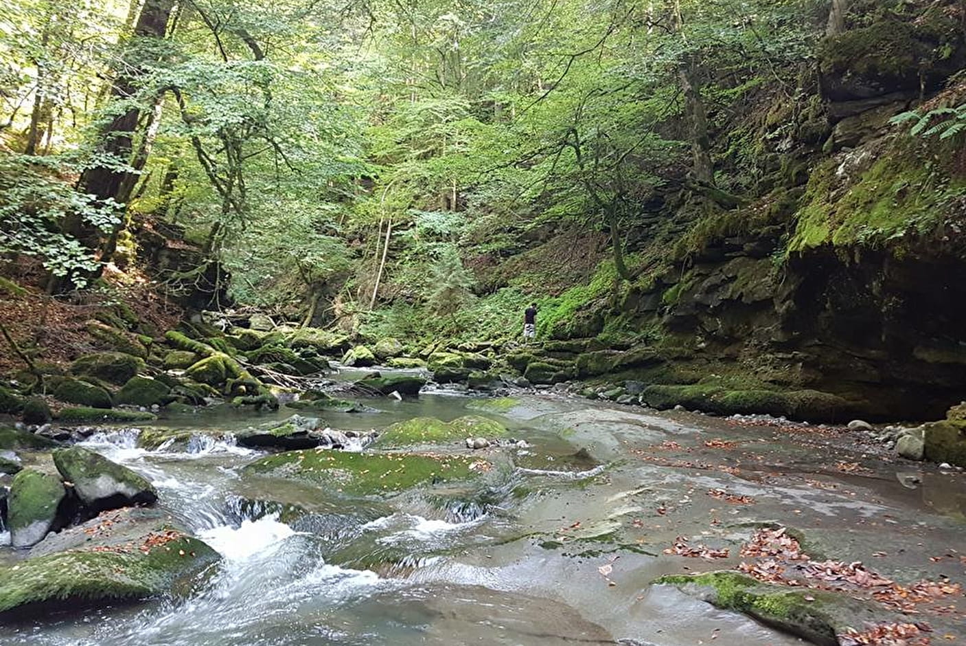
The route takes you in the shade of the Bois de Traversiers, on the banks of the Nom. This torrent is one of the four tributaries of the Fier, taking its source at the Col des Aravis.
This walk without difficulty, will offer you a moment of calm along the water.
- Sport
Circuit du Nom

Savoie Mont Blanc's choice
Sport Circuit du Nom Saint-Jean-de-Sixt
About

Topoguides references
Page 13, circuit 8. Family walks guide for sale at the Tourist Office at 3€
Further informations
Stone, Ground
1 8


The hiker's 12 commandments, respect and safety:
.
- Goud sense, safety and respect:
Walking in an unspoilt environnment is a delight! To make sure that our children also have the opportunity to enjoy this magical experience, please be a civic-minded, responsible hiker.
.
- Make the right choice:
Is the hike you have planned suited to the weather conditions, your physical abilities, your equipment and the amount of time you have available? Before you set off, tell your friends and family about your itinerary. In the mountains, you must always take care. You are responsible for your own safety and of the others.
.
- Find out about the weather conditions:
Wheter you are going on a short or long excursion, it is essential to check the weather forecast: the weather in the montains can change very fast (storms, fog, etc...).
Setting off early in the morning, even if the hike can be done in half a day, allows you to deal with any unforseen circumstances and gives you a better chance of seeing wildlife. if in doubt, it is always best to cancel if you want to be sure of avoiding problems.
.
- Keep to the paths:
Do not take shortcuts. Trampling the vegetation causes erosion, which can quickly cause an environment to deteriorate. The state of the paths may also change according to the weather conditions, seasons and how many people are using them. Caution: if you come across downhill mountain bike trails where pedestrians are not allowed for safety reasons, take care and follow the instructions shown on the path.
.
- Be discret:
We are not the only ones using the paths. Let's be considerate of others and keep the countryside a peaceful place to be.
.
- Admire the flowers but do not pick them, and please take your rubish home with you:
Nature needs you.
.
- If a site allows dogs, please keep your dog on a lead:
It could harm wildlife and disturb livestock.
.
- Close fences and gates behing you, and avoid walking on crops:
Respect private property and fields of crops or mountain pastures, and close the gates behind you. Do not disturb wild animals. If you come across a dog guarding livestock (known locally as a patou), do not approach it. They are there to protect the herds.
.
- Follow site-specific rules:
Some protected natural areas have their own specific rules: dogs, bivouac, fires and picking the plants may be prohibited. In private forests, picking forest plants like mushrooms is forbidden. In public forests, they may be picked sparingly.
.
- Avoid fires:
Particularly in high-risk areas. Fire can spread very fast in covered environments (forests) or overly exposed areas (scrub, dry moorland).
.
- Take care:
Do not drinl the water from the streams. Clear water does not mean drinking water, especially in pasture areas where the animals may have soiled the rivers.
.
- Tell someaone where you are going on your hike:
Where possible, do not walk alone. There are risks involved in using the paths, injury for example. In all cases, always make sure that someone knows where you are going and what time you should go back.
0/ Parking of the Saint Jean de Sixt Tourist Office
1/ From the Tourist Office, go to the church and follow the street to the right of the sports shop, then turn right at the Passerelle road sign. Continue straight and go down to the torrent. Cross the footbridge and follow the watercourse until you reach the asphalt road.
2/ Turn right just before the bridge to reach an old stone bridge and a staircase to go up to the village. At the fence of the works, turn left along this fence and then follow the road to exit at the level of the road of Thônes. Turn right to return to the church.
Prices
Free of charge.
Reception
Period of practice
Information at the Tourist Office
Subject to and weather conditions.
Services
- Pets welcome