
From the chapel ND des Vernettes take the path that goes horizontally on the left opposite the chapel towards the Entreporte pass. The path crosses the forest, forks to the right before the combe ski lift.
Stay on the edge of the plateau at the edge of the forest and follow the path upwards. This path crosses the Rey plateau under the shoulder of the Aiguille Grive (quite steep, sometimes tricky passages) then winds through a dolomitic landscape under the cliffs of ochre and grey cargneules of the Aiguille Rousse, before arriving at the Entreporte pass. In the mountain pasture, take the path towards the Col de la Chail. At the first intersection (after the Plan des Eaux chalet) turn right and go down the valley towards Les Rossets. The track continues in the direction of ND des Vernettes. Leave the track at the first bend in the forest of Carro Blanc to take a small steep path that leads to the chapel.
- Sport
Chapel Notre Dame des Vernettes to the Col de l'entreporte
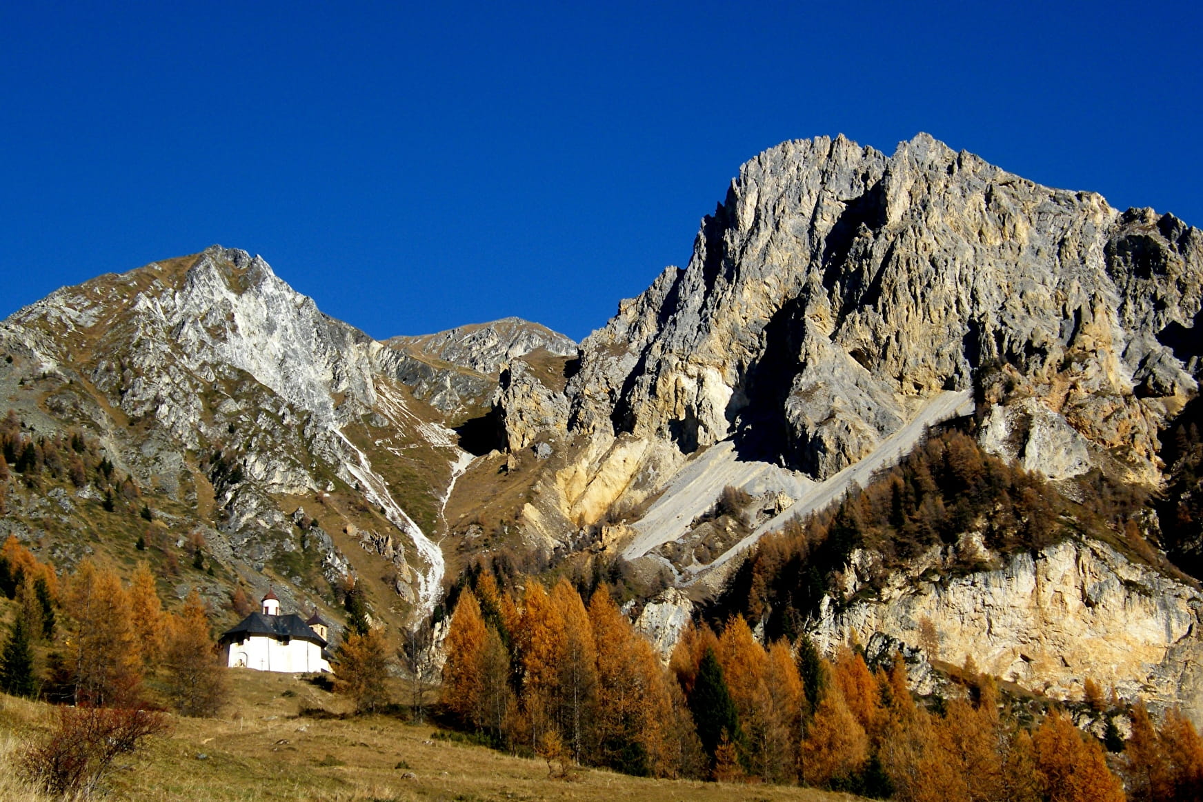
Diversité des paysages et ambiances pour cette randonnée : des forêts aux alpages en passant par les vertigineuses dolomites de l'Aiguille Rousse.
About

Signs
Yellow, red
Difficult passages
Some steep passages can impress people prone to vertigo. In the same way it is prudent not to engage yourselk in bad weather condition and especially to climb to the Col d'Entreporte. Under the shoulder of the Aiguille Grive (passages quite stiff, sometimes delicate).
Map references
TOP 25 IGN 3532 ET Les Arcs la Plagne
Further informations
Stone, Ground


From the chapel ND des Vernettes take the path that goes horizontally on the left opposite the chapel towards the Entreporte pass. The path crosses the forest, forks to the right before the combe ski lift.
Stay on the edge of the plateau at the edge of the forest and follow the path upwards. This path crosses the Rey plateau under the shoulder of the Aiguille Grive (quite steep, sometimes tricky passages) then winds through a dolomitic landscape under the cliffs of ochre and grey cargneules of the Aiguille Rousse, before arriving at the Entreporte pass. In the mountain pasture, take the path towards the Col de la Chail. At the first intersection (after the Plan des Eaux chalet) turn right and go down the valley towards Les Rossets. The track continues in the direction of ND des Vernettes. Leave the track at the first bend in the forest of Carro Blanc to take a small steep path that leads to the chapel.
Prices
Free access.
Reception
Period of practice
From 01/06 to 31/10.
Remember to contact your Tourism Officeto learn about the feasibility of the paths.
Subject to favorable weather.
- Pets welcome
Contacts
Access
Departure from the chapel of Notre Dame des Vernettes
- Not accessible in a wheelchair


