In the hamlet of La Charmette (1), follow the red and white signs of the GR9 to the Habert of Chamechaude. At Les Jailleres, go straight ahead. At Le Bruchet, keep following the GR9 to the Habert of Chamechaude. Once you have reached the habert, take left (2). At the cabane de Bachasson (3) (only watering place on this itinerary) follow Chamechaude until you reach the top (4). There, enjoy the amazing view! Go back on yourself to the cabane de Bachasson. At the cabane, go down on the right and follow Col de Porte. At the col (5), take the yellow and red marked path on the left (GR de Pays) to Le Sappey-Église. When the forest track meets the road, take it for about 30 meters and go down on the right on the Chemin des Chartreux (yellow signs). At the last junction, keep following Le Sappey-Église to get back at the car park (6).
- Sport
Loop of Chamechaude
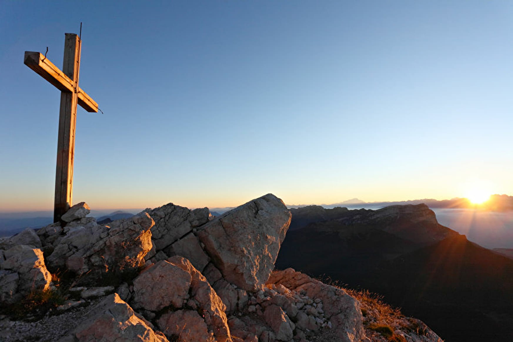
Suitable for experienced walkers only, this loop up to the peak of the Chartreuse mountains is an alternative to the simple path to and from the Col de Porte.
Sport Loop of Chamechaude Le Sappey-en-Chartreuse
About

Prices
Free of charge.
Reception
Period of practice
From 01/05 to 30/11.