

Saint-Pierre chapel marks the beginning of your journey. The sounds of the alpine herds echo the marmots' whistles in the distance. The terrace of the 2000 trail seems to trail off to infinity. In the background, the regal Roche d'Étache cuts the horizon. The stage is set for retracing the military history of Col du Mont Cenis. Give in to the temptation of taking various scenic breaks, made easy by the gentle terrain. Gain a little more height as you overcome the only difficulty of the day and then, take your seat! At almost 2,300 m of altitude, this circular fort is an infallible observation post! Though peace and quiet have reigned here for over half a century, you can still feel the weight of history. As far as the eye can see, ridges draw jagged lines across the sky, reflected in the turquoise waters of the lake. There's no doubt about it: the horizon is all yours!
- Sport
Ronce Fort via Sentier des 2000
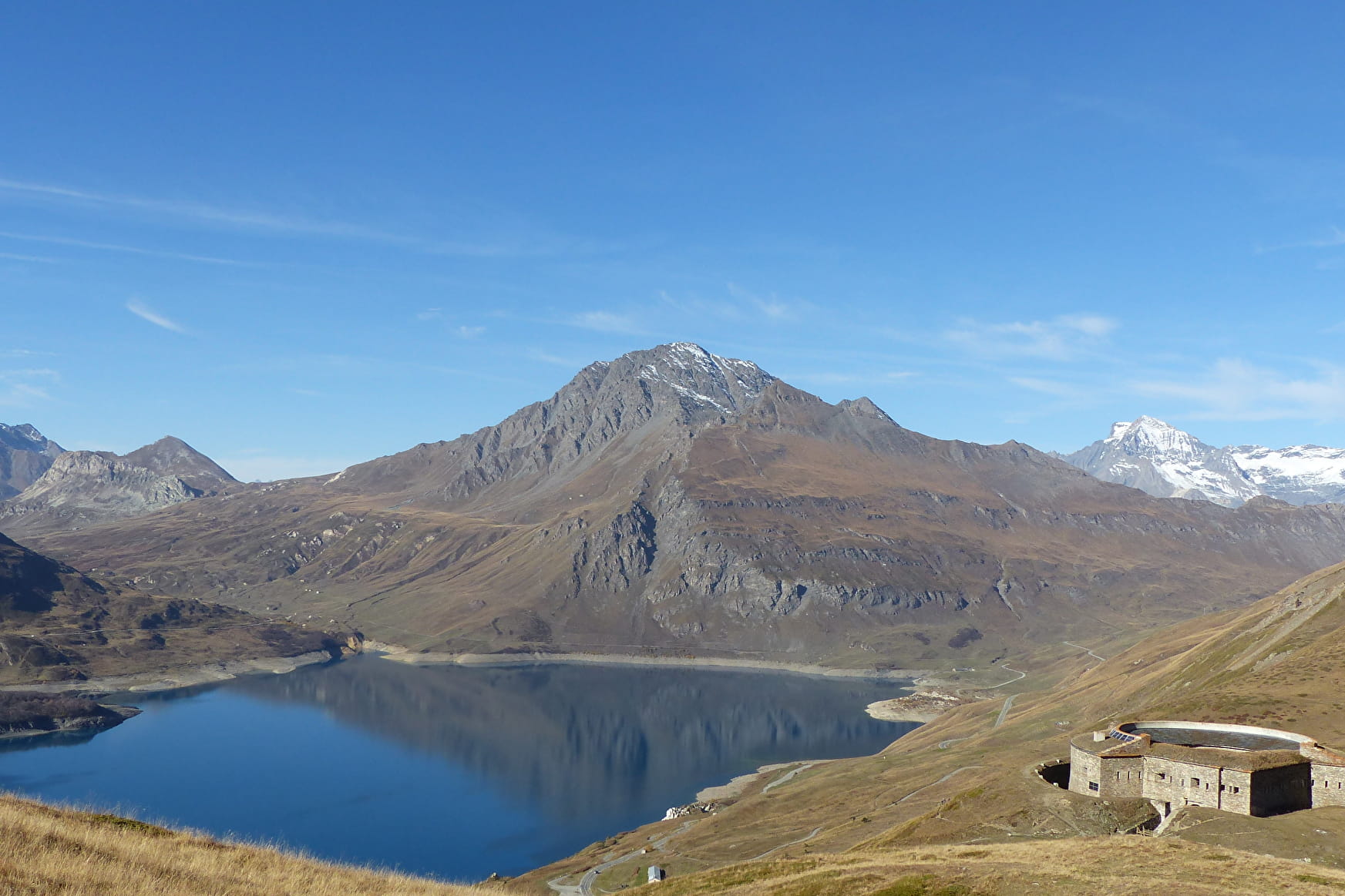
The time machine takes you back to the past of Italian soldiers. Grab front row seats on this terraced trail with breathtaking views. Seek out the best photo agnles and take your time diving into the history of this emblematic site.
Sport Ronce Fort via Sentier des 2000 Val-Cenis
About
Signs
Departmental signposting (PR)
Map references
Map and Booklet "Balades et Randonnées Haute Maurienne Vanoise" (sold 10 € at the Tourist Office)
Topoguides references
Orange route n°65
1 1

To guide you in the field, consult the "step-by-step" directional diagram provided in pdf.
Prices
Free access.
Reception
Pets allowed on leash only.
Period of practice
From 15/06 to 15/10.
Subject to favorable snow and weather conditions.
Services
- Pets welcome
- Parking
Contacts
Access
I'm going by car: park in the parking lot at the Col du Mont-Cenis.
