You'll be warming up right from the start with a succession of climbs and descents before reaching the highest point of the itinerary. The rather technical descent that follows is an absolute must, comprising singletrack forest paths that include some steep sections and hairpin bends that require some skill. All put together in a varied yet consistent alternation of technical challenges and more amusing sections. Make a few stops to recover your breath and, as on almost any trail in Haute Maurienne Vanoise, you can contemplate the beautiful panoramic views, especiallly over the majestic Dent Parrachée and the Vanoise glaciers. When the sky is clear you can even see the Aiguilles d'Arves and Ecrins.
Once you reach Bramans the return trip depends on how fit you're feeling, either up the Chemin du Petit Bonheur, or by a shuttle bus which is equipped to carry bikes. Why the name? Because this area is a fortification hotspot, especially near the Replat des Canons.
Departs from: Mont Cenis Pass or the lifts at Val Cenis Termignon.
29- Enduro - Black - Canon Ball
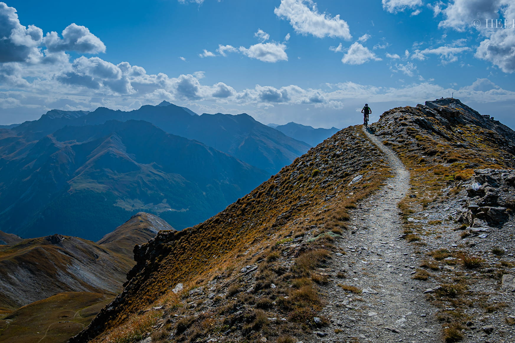
This out-of-the-ordinary trail offers the perfect combination of breathtaking scenery (views of the Aiguilles d'Arves, Ecrins, Dent Parrachée and Vanoise glaciers), technically challenging climbs, amusing descents and a high-mountain decor.
About

Signs
Beaconing French Cycling Federation
Map references
Haute Maurienne Vanoise mountain bike map sold at the Tourist Office.
Topoguides references
Haute Maurienne Vanoise mountain bike booklet sold in the Tourist Offices
Further informations
Stone, Grit, Ground
Prices
Free access.
Period of practice
From 01/07 to 01/10.
Subject to favorable snow and weather conditions.
Contacts
Access
Departure from the Mont Cenis pass, parking nearby.
During the summer season, a departure is also possible from the Val Cenis Termignon ski lifts. Possibility to take the bus line S53 (Modane - Bonneval/Arc) and get off at the stop "Maison de la Vanoise / Mairie"; bus equipped with a bicycle trailer every day except Saturday.