The 2084-m high Col du Mont-Cenis towers above the Maurienne and Susa Valleys, at the heart of the Mont-Cenis Range.
This prestigious pass marked the border between France and Italy until 1947. The very narrow road that existed under the First Empire (wagons had to be disassembled and carried on mules) was widened by Napoleon Bonaparte, with construction taking ten years, from 1803 to 1813, and involving the toil of 3000 labourers. During the work, the 9th-century hospice was extended so it could provide shelter for poor travellers, not for travellers “who thanks to their fortune can enjoy the hospitality of the inns set up along the road”, to quote the rules introduced by the Bishop of Saint-Jean-de-Maurienne.
Pope Pious VII stayed at the hospice in 1812. He was in such poor health he was given the last rights but, against all expectations, he recovered and was able to get back to France.
There are some kilometer markers during the Mont-Cenis itinerary.
- Sport
Col du Mont Cenis from Lanslebourg
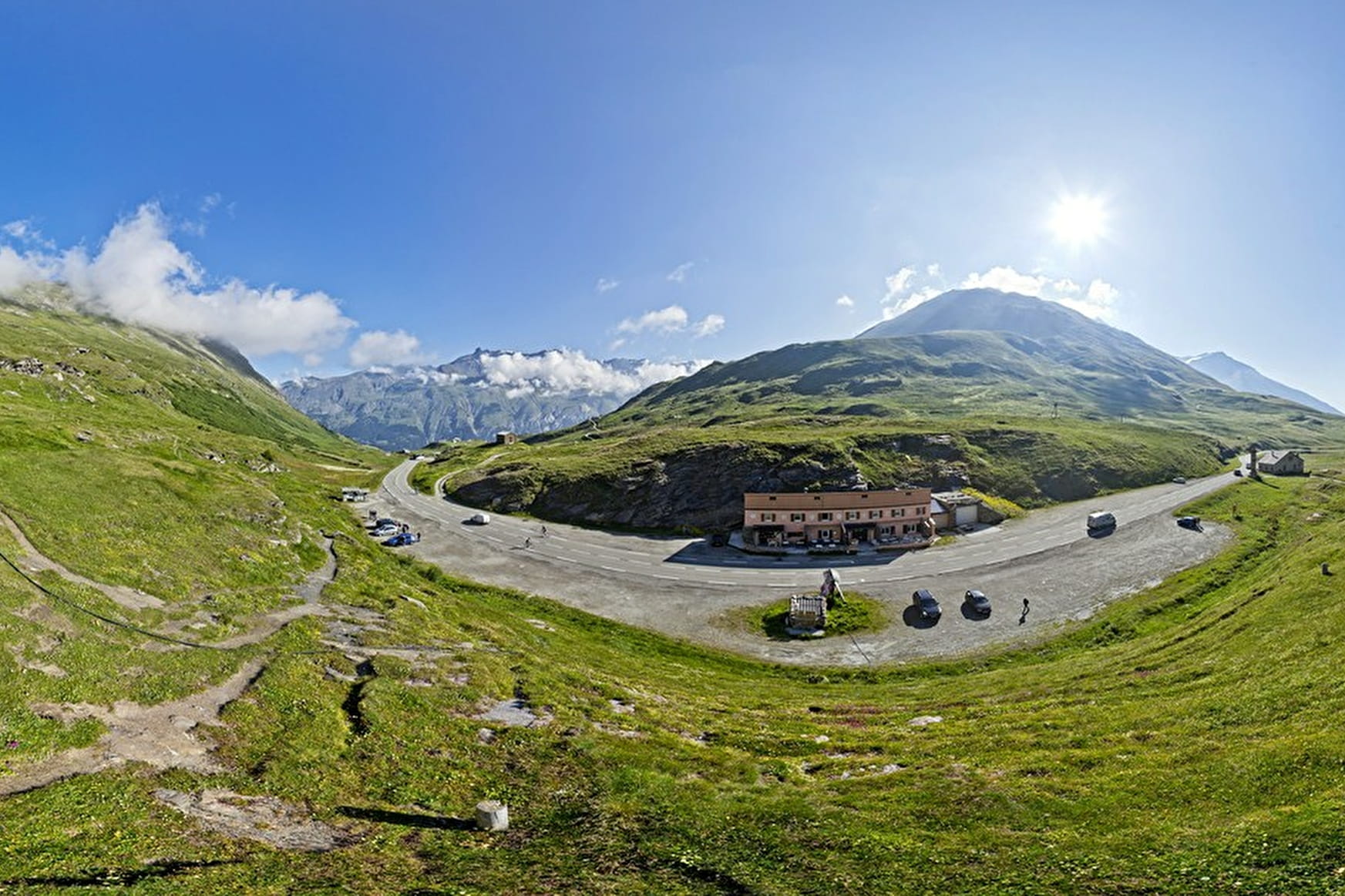
Kilometre posts line the road to the Col du Mont Cenis, which culminates at almost 2000 m, beside the eponymous lake. The road continues to the Col du Petit Mont Cenis, where there is a nice, friendly mountain hut.
Sport Col du Mont Cenis from Lanslebourg Val-Cenis
About

1 9


Prices
Free access.
Reception
Period of practice
From 01/05 to 31/10.
Subject to favorable snow and weather conditions.
Equipments
- Picnic area
- Bar
- Public WC
- Orientation board
- Parking